Add a Curriculum Bundle to Your Account!
Please select a bundle.


The Pack contains associated resources for the learning experience, typically in the form of articles and videos. There is a teacher Pack (with only teacher information) and a student Pack (which contains only student information). As a teacher, you can toggle between both to see everything.
Here are the teacher pack items for Southeast Asia: Geographic Passport:


In this experience, students are introduced to the physical geography of Southeast Asia. They explore maps in order to understand geographic features of the region. They learn about the Ring of Fire and its effect on Southeast Asia. Finally, they focus on the connection between geographical setting and human patterns of movement. Objectives:Overview:
Southeast Asia consists of eleven different countries, both mainland and islands: Thailand, Indonesia, Vietnam, Singapore, Philippines, Myanmar, Malaysia, Laos, East Timor, Cambodia, and Brunei. This vast region includes rivers, rainforests, mountain ranges, deltas, and active volcanoes. In this experience you will learn about the physical features and climate of this diverse region—and how those features have connected with human patterns of movement over time.
Objectives:
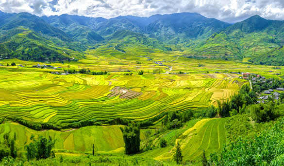
Terraced rice fields in Vietnam
To begin your exploration of Southeast Asia, take a virtual tour: 64 Breathtaking Photos From Southeast Asia.
Write one interesting thing you saw in the tour and one question you have about the region.

As a class, discuss students’ observations. Then discuss student questions. Encourage students to look for answers to their questions as the experience proceeds. If there is time at the end, return to student questions to see if they were answered.
Students will be using the National Geographic Mapmaker site and tool in the next scene. If they need additional guidance on using the tool, refer to the Making Maps: Tutorial experience.
When everyone is ready to continue, unlock the next scene.


